Field instrumentation
Several types of instruments are deployed over the Argentière glacier in the framework of the SAUSSURE project :
Automatic Weather Stations (AWS)
|
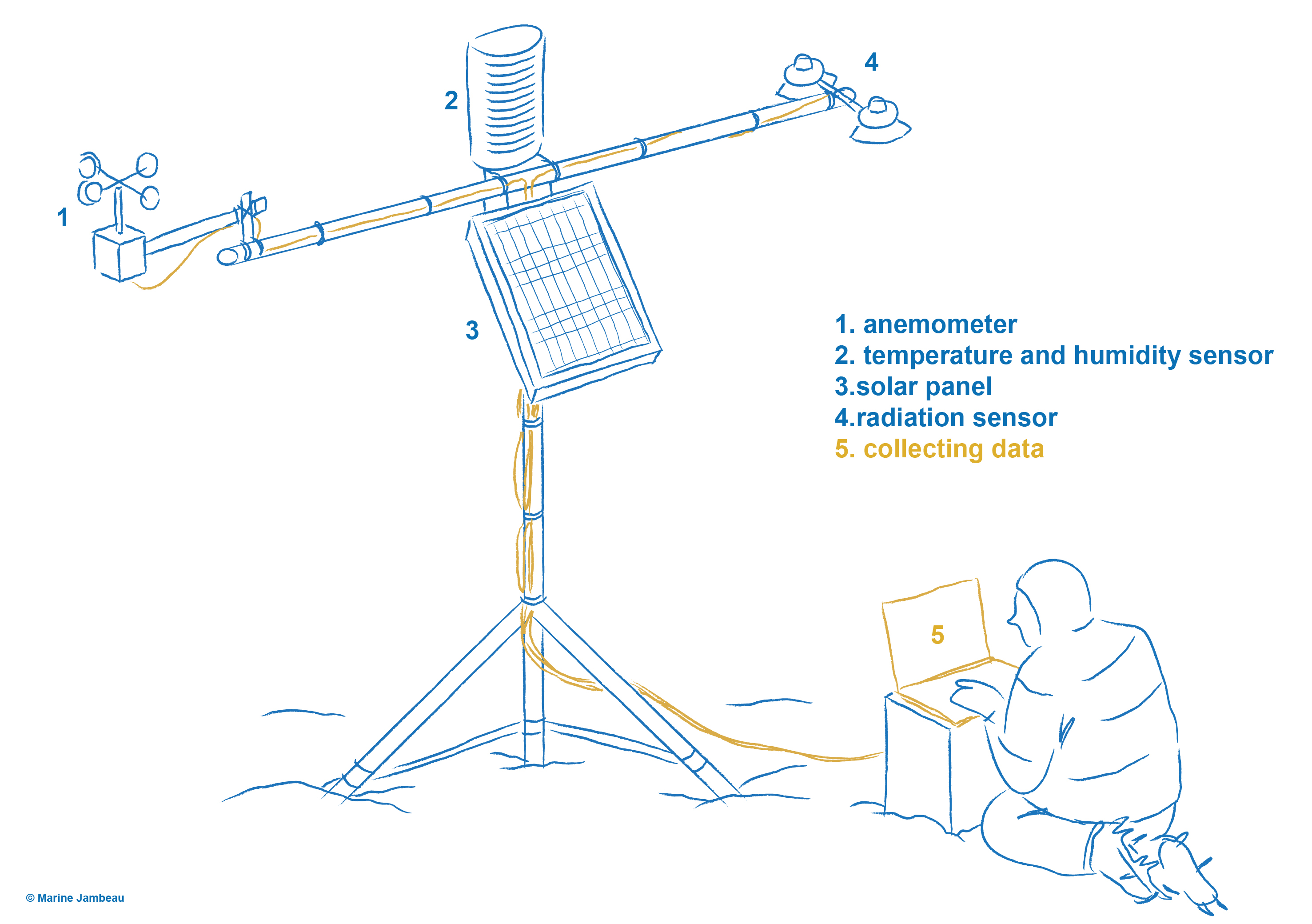
An Automatic Weather Station directly setup on the glacier, completed by a network of ablation stakes (and probes), will allow to assess the amount of water available at the surface of the glacier, in the vicinity of the investigated area, at a high temporal resolution (hour) during the two 6-month campaigns. This will be done using an energy balance models driven by this dataset. The surface mass balance (accumulation and ablation) over the whole surface area of the glacier at a daily scale will be inferred using a combination of an enhanced degree day model and stakes measurements. Delphine Six is in charge of the AWS. |
Cavitometer
|
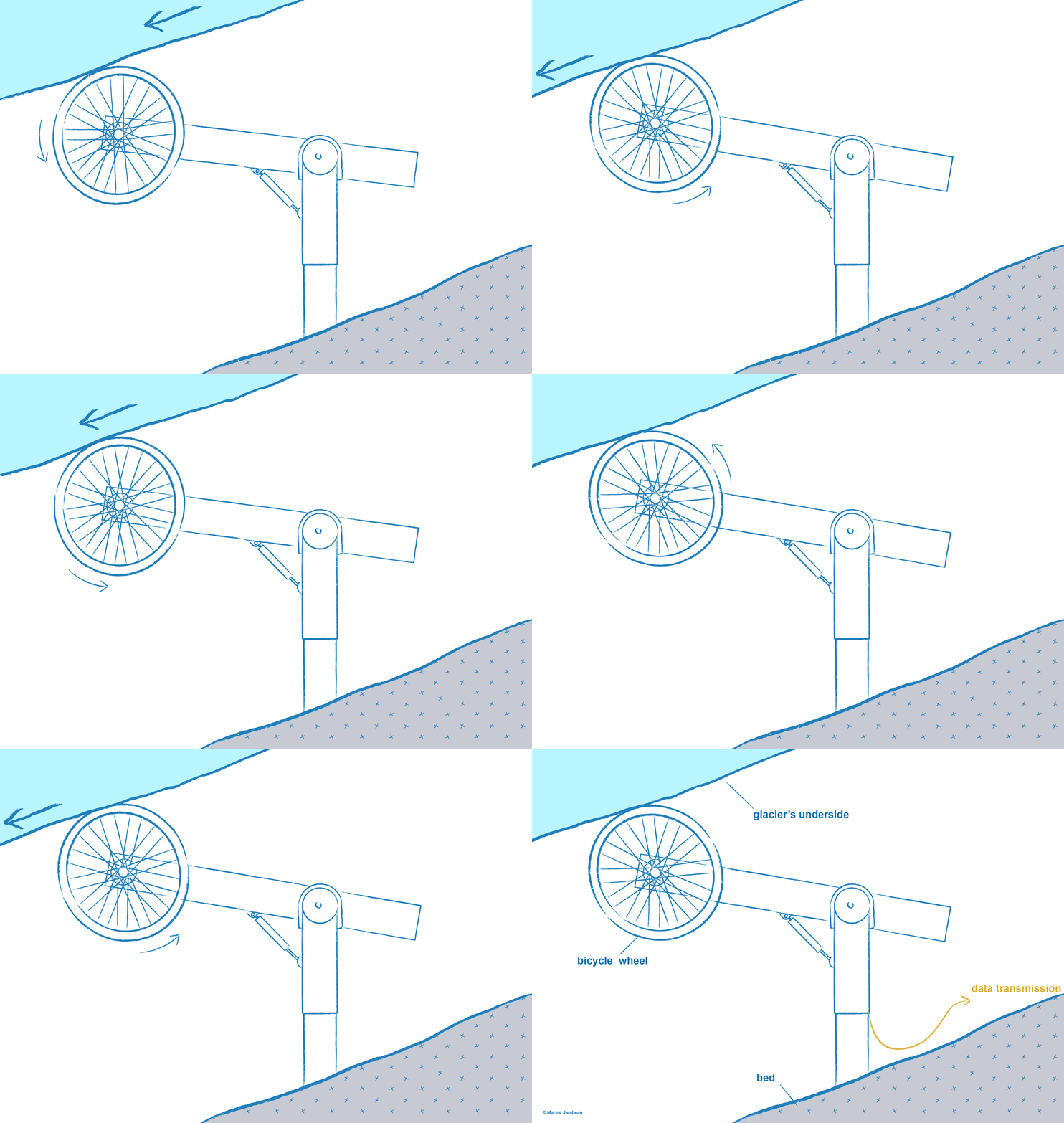
The cavitometer is a unique tool allowing a direct measurement of the sliding velocity at the base of the glacier. It is simply composed of a bicycle wheel attached to a 1.30 m long articulated arm that is fixed to the rock and placed in a natural cavity, free of water, that opens behind a bedrock bump. Sliding velocity are measured at an hourly scale from this subglacial laboratory since 2017 thanks to a new potentiometer and a new numerical logger. Daily sliding velocities were measured almost continuously since 1997. Luc Moreau is in charge of this measurement. |
Hot water driller
|
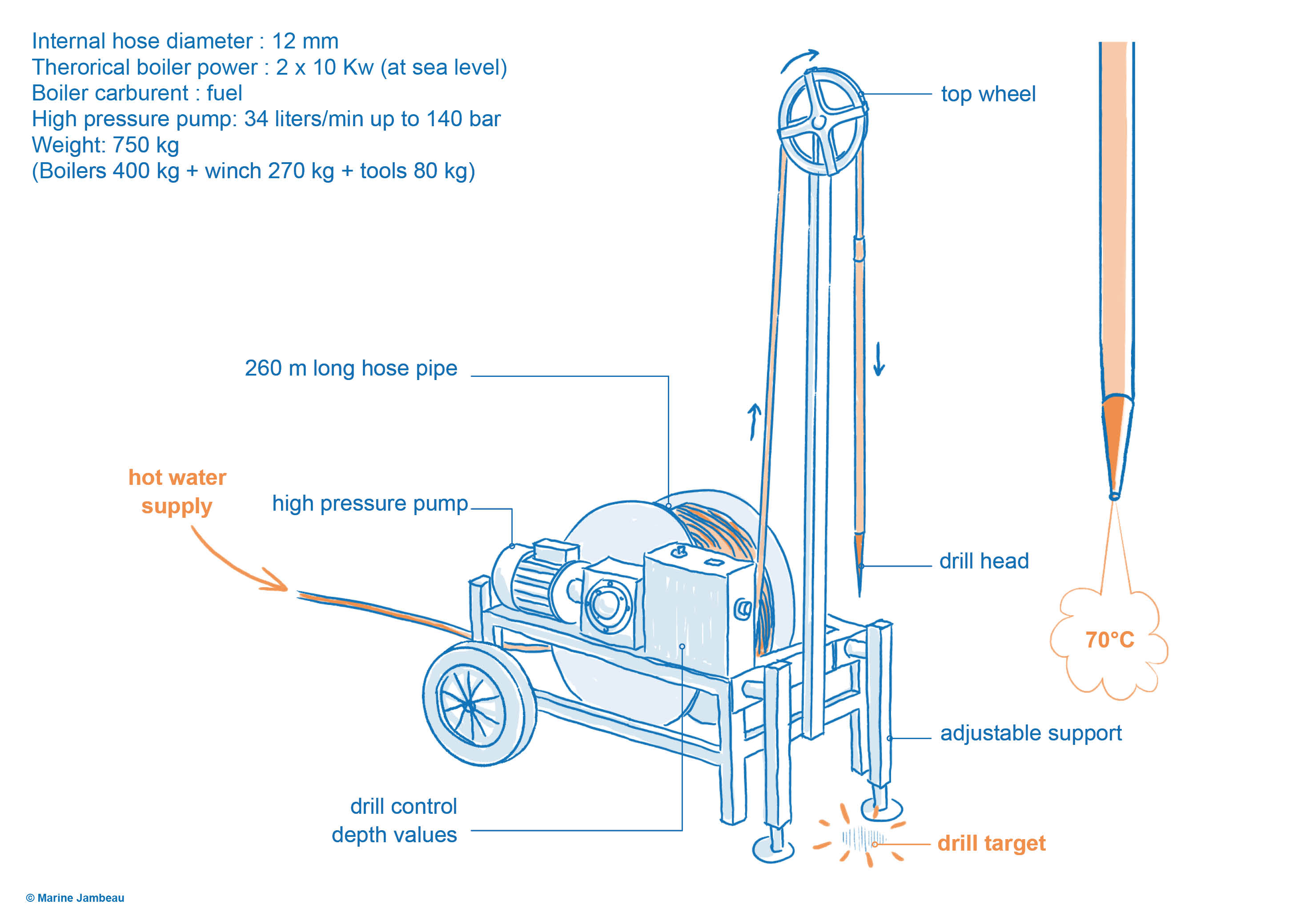
During the project, a number of boreholes will be drilled at about 150 to 240m deep from the glacier surface down to the glacier base using a hot water drilling machine available at IGE. Luc Piard is in charge of this instrument. The hot water driller have been used with success to drill 5 holes down to the bedrock during the September 2019 field campaign. |
Tilt-meters
|
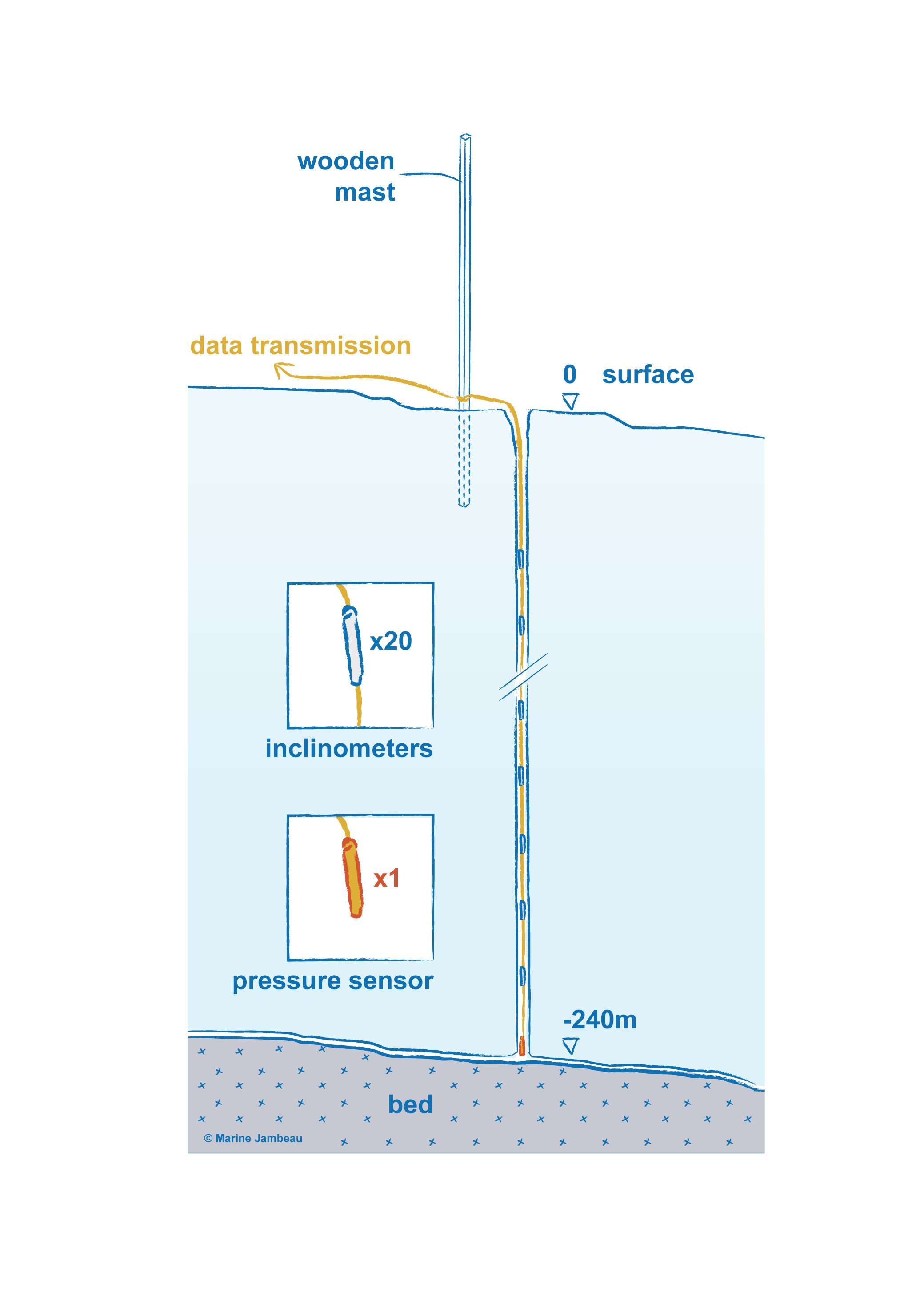
A tilt-meter is an instrument that measures its own tilt relative to the gravity. In each borehole, we will deploy a chain of tilt-meters in order to reconstruct the ice deformation from its base up to the surface. This will allow estimating which part of the observed surface velocity is due to ice deformation, and therefore estimating the basal sliding at the borehole location. Luc Piard is in charge of this instrument. |
Unmanned Aerial Vehicule (UAV)
|
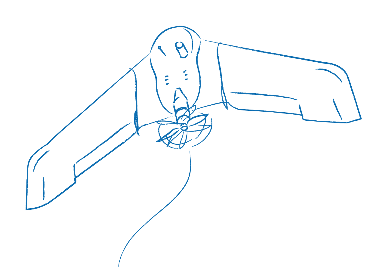
La topographie 3D du glacier (DEM, pour Digital Elevation Model) peut être reconstituée par photographie aérienne, à l’aide d’un véhicule aérien sans pilote (UAV). Nous utiliserons régulièrement un drone E-Bee, de la société Sensefly, pour surveiller la variation de la topographie de la surface du glacier. Combiné avec des cibles précisément référencées (mesures DGPS), le modèle de surface obtenu peut atteindre une précision de qu3D topography of the glacier (DEM, for Digital Elevation Model) can be reconstructed by aerial photography, using Unmanned Aerial Vehicule (UAV). We will regularly use an E-Bee UAV, from Sensefly Company, to monitor the variation of the glacier surface topography. Combined with precisely referenced targets (DGPS measurements), the surface model obtained can reach a precision of a few centimetres. Two operators are needed to implement each flight. Bruno Jourdain from IGE is in charge of this task. |
 The federation
 Intranet


